|
|||||||
|
|||||||
|
|
|
|
|
|
|
Anguillaja and Fatonero’s pot-holes have been moulded directly into the
rock and their dimensions may vary from a few centimetres until reaching
a diameter of 6.6 m and a deepness of 1.6 m. |
|
|
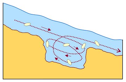
Anguillaja and Fatonero’s pot-holes seem to follow this traditional
model, as presumably demonstrated by the regular signs left by
mechanical erosion on the internal borders of a number of these
pot-shaped cavities. |
Pot-hole wall with evident traces (scallops) |
|
|
|
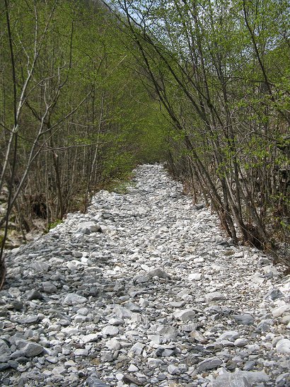
sub-riverbed water flow along Tùrrite Secca stream Antonio Stoppani (1824-1891) – Italian geologist and palaeontologist – was here on 13th June 1872 to estimate the value of Val d’Arni marble (later called “the White Valley”). On that occasion, the famous scientist observed and understood the phenomenon of sub-riverbed water flow along Tùrrite Secca stream. You can read the original description in Il Bel Paese (“The beautiful Country”), published in 1876. Stoppani wrote: “the riverbed instead of collecting the tributary streams, becomes the roof covering all of them…”. The Tùrrite Secca water resurfaces from Pollaccia spring, near Isola Santa village, about one kilometre further down, as the geologist tell us in his book. The karst absorption makes dry the riverbed, but water suddenly floods during the severe thunderstorms. You can walk safely along this natural “cobble street” on days without rain. In the 19th century, Tùrrite Secca dry riverbed was the only trail linking Val d’Arni and Castelnuovo di Garfagnana. On the left: Tùrrite Secca dry riverbed |
|
|
||