|
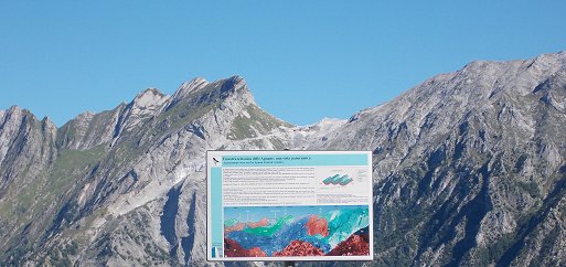
The location of panoramic viewpoint,
along the provincial route from Massa to Arni
Geological
interpretation of the spectacular landscape and outcrops of the
Frigido's Valley:
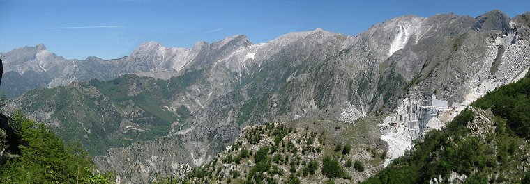
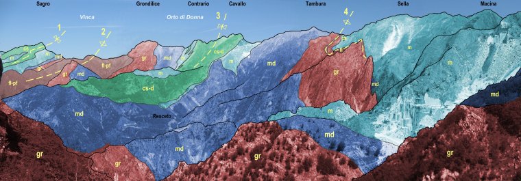
From here it is easy to observe one of
the most suggestive geologic panoramic views in the Apuan Alps, already
illustrated by Domenico Zaccagna, engineer and geologist in 1881.
It is possible to see two main ridges; in the background the ridge
includes the peak of these main mountains from east towards east: Sagro,
Grondilice, Contrario, Cavallo, Tambura, Sella and Macina. In foreground
the Mandriola crest, above the village of Resceto, joins at M. Cavallo
towards the north east.
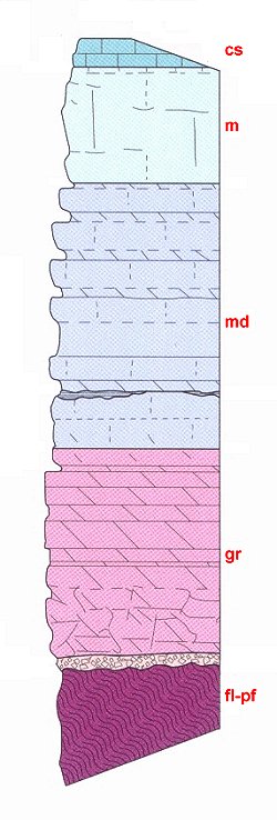
We can observe and identify the geological structure of the Apuan Alps
consisting in a fold system of kilometric anticlines and synclines that
caused repetitions of rocks, showing different age and composition.
From the western portion of the geological panoramic view toward the
east we can see:
Mt. Sagro Syncline (n. 1 on the
picture); Vinca Anticline (n. 2); Orto di Donna Syncline (n. 3); Mt.
Tambura Anticline (n.
4).
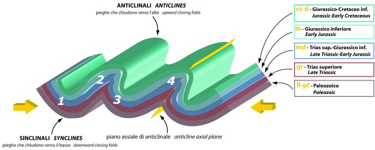
Structural
interpretation of the Apuan tectonic window in the northern area:
1) Mt. Sagro syncline; 2) Vinca anticline; 3) Orto di Donna syncline; 4)
Mt. Tambura anticline
fl) lower phyllites; pf) porphiroids and porphiritic schists; gr)
“grezzoni” dolomites; md) dolomitic marbles; m)
marbles s.s.; cs) cherty limestones; d) radiolarites
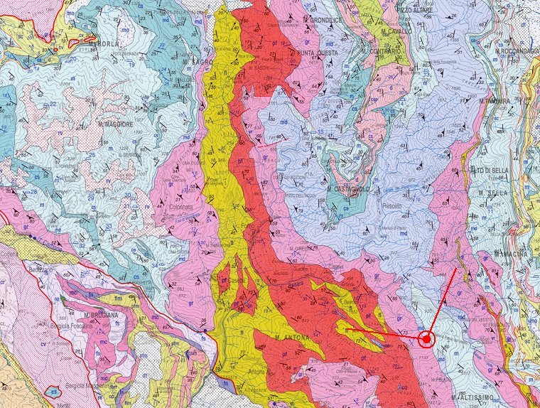
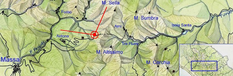
Geological map of the Frigido's
Valley with the location of panoramic viewpoint
|